Master Data
Geodata Source
Abteilung Küste, Staatliches Amt für Landwirtschaft und Umwelt Mittleres Mecklenburg
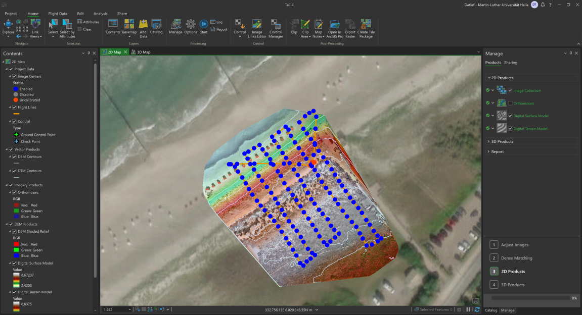
Befliegung zur Detektion von Strandhafer innerhalb von 4 Transsekten zwischen Ahrenshoop und Weststrand.
Sonniges, windiges Wetter, Böen um die 40 km/h.
Datengrundlage für Zeitreihe zur Analyse von Dünensukzessionen und Strandhaferdetektion.
Prozesierte Daten 2 cm geometrische Auflösung, Flughöhe war 30 Meter mit DJI Inspire 2 und Micasense MX Red Edge MX Dual (10 Bänder)
Prozessierte Produkte jeweils jeweil Orthomosaik, NDVI, DSM und DTM mit Drone2Map
Dataset Properties
Dataset Format
Dataset Type
Sensor Type

Spatial Information
Projection
Temporal Information
Copyright Information
MLU Halle - Wittenberg
Detlef Thürkow
Von-Seckendorff-Platz 4
Institut für Geowissenschaften und Geographie
06120 Halle (Saale)
Germany
MLU Halle - Wittenberg
Detlef Thürkow
Von-Seckendorff-Platz 4
Institut für Geowissenschaften und Geographie
06120 Halle (Saale)
Germany
MLU Halle - Wittenberg
Detlef Thürkow
Von-Seckendorff-Platz 4
Institut für Geowissenschaften und Geographie
06120 Halle (Saale)
Germany