Master Data
Geodata Source
Kliffbefliegung
Identifier
//Geodaten/uav/DE_MV_Ahrenshoop/20240425_micasense/results/Wustrow Kliff 26042024 Micasense_dem_5cm.tif
//Geodaten/uav/DE_MV_Ahrenshoop/20240425_micasense/results/Wustrow Kliff 26042024 Micasense_ortho_norm_2cm.tif
Bounding Box
Dataset Properties
Dataset Format
Dataset Type
Data Size [MB]
8480.00
Sensor Type
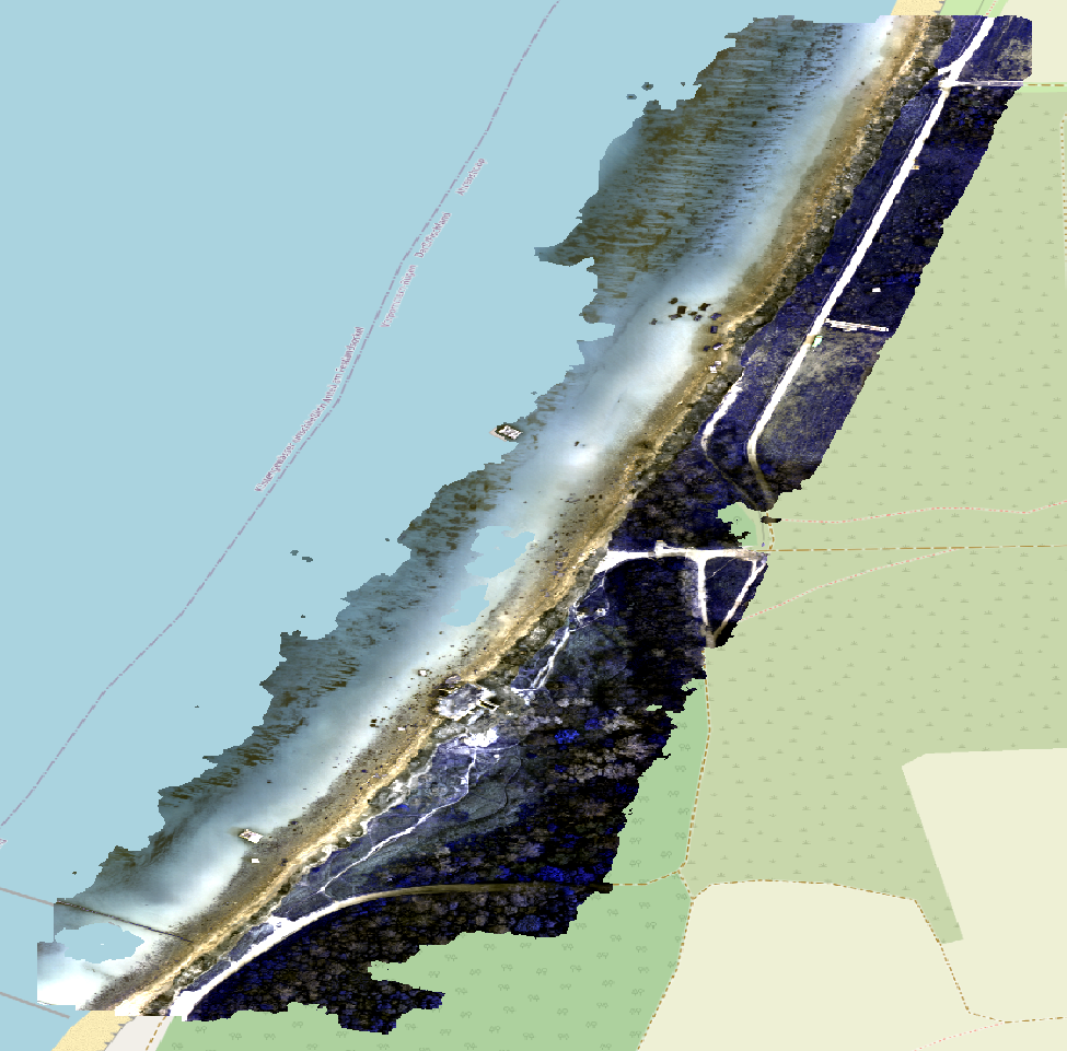
Preview Bitmap
Spatial Information
Spatial Coverage
Central Europe
Spatial File
bb_ahrenshoop_0.kml
(1.19 KB)
Projection
Spatial Resolution
2x2cm
Koordinaten
POINT (12.399005199803 54.364263435876)
Temporal Information
Copyright Information
Dataset Creator
MLU Halle - Wittenberg
Von-Seckendorff-Platz 4
Institut für Geowissenschaften und Geographie
06120 Halle (Saale)
Germany
Dataset Publisher
MLU Halle - Wittenberg
Von-Seckendorff-Platz 4
Institut für Geowissenschaften und Geographie
06120 Halle (Saale)
Germany
Dataset Contributor
MLU Halle - Wittenberg
Von-Seckendorff-Platz 4
Institut für Geowissenschaften und Geographie
06120 Halle (Saale)
Germany
Access Rights
Language